Ellis Peak
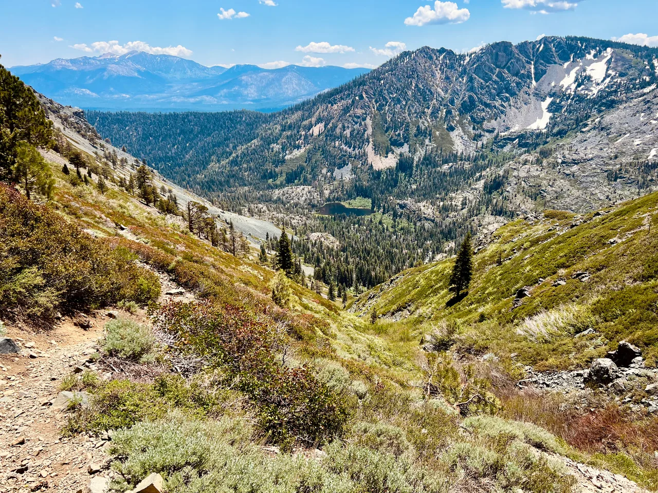
A steep west-shore climb reaches a high viewpoint above Lake Tahoe and the surrounding wilderness. Ellis Peak suits hikers who want a rewarding mountain half-day and do not mind earning the view immediately.
- Distance
- ≈ 6.2 mi
- Elevation gain
- ≈ 1,400 ft
- Time estimate
- 3.5–5 hours
- Effort
- Hard
Why go
Ellis Peak starts with real work. The trail climbs steeply from the high road, then carries you across a landscape that offers both Lake Tahoe and the mountains beyond its western rim. Treat the rolling terrain as part of the outing: a destination that appears close on the map can still require repeated climbing.
This version goes to the peak and returns to Barker Pass Road. Ellis Lake is a separate side-trip decision, not hidden inside the advertised distance. Leave enough time for a long summit pause and a careful descent. The trail is shared with permitted motorized users, which gives the day a different character from a wilderness-only walk.
The walk
Out and back · Ellis Peak Trailhead on Barker Pass Road
Start at the signed Ellis Peak Trailhead near the point where Barker Pass Road changes from pavement to gravel. Confirm you are not starting at the separate PCT trailhead.
Follow the Ellis Peak trail through its steep opening climb and rolling ridge sections. Use the mapped peak route at junctions rather than adding the lake spur unintentionally.
Reach the summit by the established route, take in the panorama, and retrace your steps. Budget energy for the return’s uphill sections as well as its descent.
A route overview for planning. Carry an offline topographic map and follow current trail signs.
Getting there & going prepared
Access depends on the seasonal opening of Barker Pass Road. The Forest Service publishes road and gate information, while Truckee Trails Foundation identifies the signed trailhead before the PCT parking area. Drive slowly on the narrow approach and watch for cyclists. Motorcycles are permitted on this trail; listen for approaching riders and share passing space.
Keep in mind
Seasonal road gates can add substantial distance; check access before treating this as a six-mile hike.
Sources & route notes
6.2 miles and 1,400 feet from published peak-only route; Truckee Trails Foundation describes approximately three miles each way. Lake detours and different starting points produce longer totals. Difficulty is editorial Hard owing to steep rocky climbing; published ratings range moderate to hard.
- Truckee Trails Foundation: Ellis Peak access
- Forest Service: Barker Pass road information
- Published peak route metrics
Source review: Oct 16, 2026. Not a field report or a statement that the trail is open. Times and difficulty are editorial planning estimates.