Ralston Peak
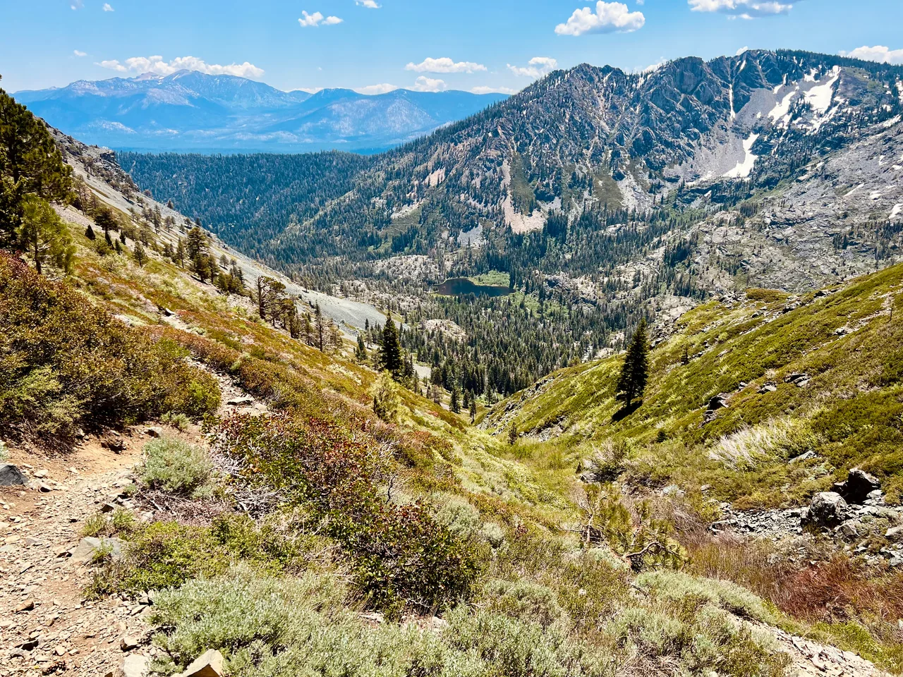
A steep climb from the Highway 50 corridor reaches a rocky summit overlooking Desolation Wilderness. Choose Ralston for a demanding uphill day and an expansive view of the country beyond Echo Summit.
- Distance
- ≈ 7 mi
- Route
- Out and back
- Time estimate
- 5–7 hours
- Effort
- Hard
Why go
Ralston concentrates its effort into the climb. The route leaves the highway corridor and gains height quickly, so an honest pace at the start pays off later. This is a summit objective for hikers who enjoy sustained uphill work rather than a gentle lake ramble. Set aside enough time to climb steadily without turning every stop into a race against daylight.
The upper mountain rewards the ascent with a broad look into Desolation's lake-and-ridge landscape. Pause before the final section to assess wind, clouds, and the group's energy. The descent retraces the same steep terrain, so tired legs still have work to do. Shortening the day before the summit is sensible if footing, heat, or lingering snow makes progress slower than expected.
The walk
Out and back · Ralston Peak Trailhead, Highway 50 opposite Camp Sacramento
Start at the Ralston trailhead opposite Camp Sacramento and follow the established uphill trail. Confirm the correct public parking and approach before leaving your vehicle.
Climb toward the Desolation trail network and use your map to locate the Ralston summit branch. Stay with the intended route rather than following informal shortcuts.
Reach the summit only if weather and footing allow, then return by the same approach. Keep checking your route through upper junctions during the descent.
A route overview for planning. Carry an offline topographic map and follow current trail signs.
Getting there & going prepared
The Forest Service identifies the approach across Highway 50 from Camp Sacramento and warns that the route has no dependable water source. Carry the day's supply. Check Desolation day-use permit instructions and current forest alerts before hiking. Dogs must remain under immediate control. Use designated legal parking and avoid assuming the highway shoulder is suitable overflow.
Keep in mind
Sustained steep climbing, limited water, and exposed summit weather require a full mountain-day plan.
Sources & route notes
Approximately 7 miles is derived from the Forest Service's 3-mile Mount Ralston trail plus a 0.5-mile summit extension each way. Published traces vary: Hiking Project lists 5.7 miles but its maximum mapped elevation (9,097 ft) is below the Forest Service summit elevation (9,235 ft). Gain is omitted rather than combining inconsistent traces; expect substantial climbing. Time and season are editorial estimates. Day-permit guidance: the Forest Service day-use page, updated September 28, 2026, limits the requirement to the installed-box summer season, while Recreation.gov still states year-round. Follow current Forest Service instructions for the visit date.
- Forest Service trail guide
- Supplemental route comparison
- Desolation permits
- Current Desolation day-use permit season
Source review: Oct 16, 2026. Not a field report or a statement that the trail is open. Times and difficulty are editorial planning estimates.